


GPS Logger e GPX Viewer: ideale per ciclismo, corsa, trekking, passeggiate, mountain bike, vela e tutti gli sport allaria aperta.
Valuta i tuoi file GPX contenenti i dati di elevazione e tempo visualizzandoli sulla mappa.
Valuta la tua attività con una grafici con la velocità e la distribuzione delle pendenze.
Visualizza e condividi splendide mappe colorando i tuoi percorsi con altitudine, pendenza o velocità.
Condividi le tue tracce con i tuoi amici per invitarli o per condividere le tue avventure.
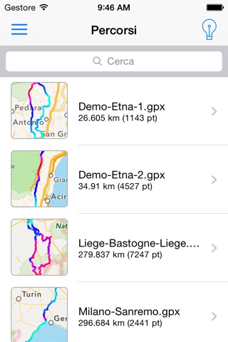
Controlla le tracce GPX realizzate da altri dispositivi e app. ***
Map Source:
- Apple
- Open Street Map / OSM
- Open Cycle Map / OCM
Track Overlay Colors:
- Altitude (Elevation)
- Slope (Grade, Climb, Fall)
- Speed
- Turn***
Support for different Unit Measures:
- Distance: m, km, ft, mi, yds, nm
- Speed: m/s, km/h, ft/s, mph, kn
- Altitude: m, ft
4 Different Graph Type:
- Altitude/Distance
- Altitude/Time
- Speed/Distance
- Speed/Time
General Features:
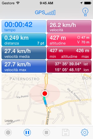
- Cycle computer
- GPX Open/Record/Save
- Support for Multi Track GPX format
- GPX Track Sharing
Languages:
-English
-Italian
-Spanish
-French
-German
**The tracks are managed in open source format GPX Track and are kept on your iOS device. You can share and receive tracks via email, via other iOS App and via iTunes File Sharing.
You can share an image with track overlay on map, data and graphs on Social Networks.
***(Enabled from Settings->Advanced Mode)
Record feature is limited on wi-fi only devices.
Important Note:
Continued use of GPS running in the background can dramatically decrease battery life.
YOUR USE OF THIS REAL TIME ROUTE GUIDANCE APPLICATION IS AT YOUR SOLE RISK. LOCATION DATA MAY NOT BE ACCURATE.